How Much Does a Land Survey Cost?
Typical Range:
$376 - $767
Typical Range:
$376 - $767
Cost data is based on actual project costs as reported by 4,059 HomeAdvisor members. Embed this data
.
.
.
.
.
.
.
.
.
.
.
.
.
.
.
.
.
.
.
.
.
.
.
.
.
.
.
.
.
.
•
•
•
•
Updated June 27, 2022
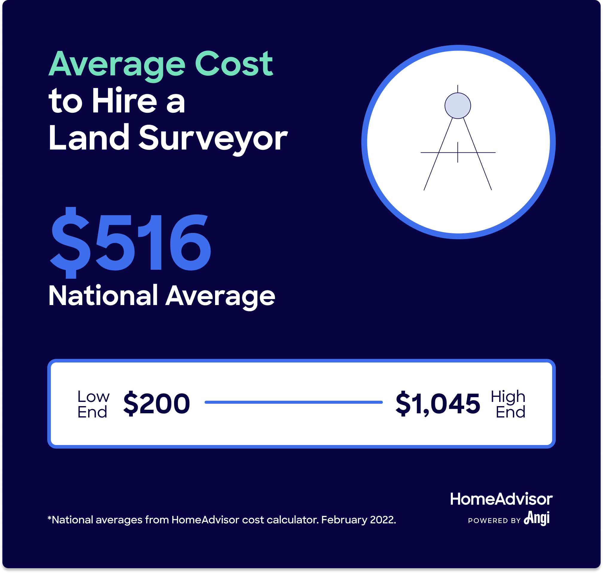
Reviewed by Robert Tschudi, Expert Home Building and Remodeling Contributor.Homeowners report that the average land survey costs around $542. This price includes the cost of hiring a land surveyor, which ranges between $376 and $767. The total cost depends on the property's history, size, location, and more, with surveys for some properties costing $1,000 or more.
Land surveys provide a legal description of where your property lines begin and end. In disputes over property boundaries, these surveys can save a lot of hassle and money because they are legally binding and professionally certified. They are also very helpful when you want to build or extend a fence, driveway, pool, or outbuilding.
Let's calculate cost data for you. Where are you located?
Where are you located?
| National Average | $542 |
| Typical Range | $376 - $767 |
| Low End - High End | $200 - $1,200 |
Cost data is based on actual project costs as reported by 4,059 HomeAdvisor members.
There are several different types of property surveys, each with its own use. Read on to learn which property survey types best fits your needs.
The price of a boundary survey is $100 to $600 on average. It is the most basic type of survey people get when they’re buying a home or pursuing a project. A professional land surveyor near you will establish the legal boundaries and provide a legal description of them.
Different states have different legal requirements, but, if you are the home buyer, it is to your benefit to get a boundary survey to know exactly how much real estate you are buying. Land surveyors often find defects that could lead to renegotiating the price of the real estate. If you’re selling your home, a boundary survey could give you valuable information to help appropriately price your home and property.
A topographic survey or review ranges from $500 to $1,200, and it’s specifically for a lot that’s smaller than 10,000 square feet in size. It locates both man-made and natural features, including streams, trees, elevations, fences, and buildings. Governmental agencies, architects, or engineers may require this type of survey before developing on a lot. Rates will be higher for plots with significant topographical elements, like rivers and hills.
A mortgage survey typically costs around $500. It pinpoints the property’s boundaries along with the precise locations of any buildings on that lot. Lending institutions and title companies often require this kind of survey as part of the financing process.
While a mortgage survey or boundary assessment is not always a requirement, you may need one if you plan to buy extended title insurance. Like a home appraisal, it can provide valuable information regarding pricing.
Additionally, a mortgage survey can be helpful for buyers to be aware of details regarding local regulation. For example, it may not be legal to build a fence dividing your yard from a neighbor’s along the adjoining boundary line. Or the driveway may encroach on a neighbor's space. A mortgage survey can help pinpoint issues to address before closing a real estate transaction.
Survey services for new construction homes can range from $1,000 to $2,000. There are several tiers involved in the process, and it will typically include boundary, topography, staking and location services.
A land study for fencing costs $250 to $1,000, depending on the lot size. If there’s already a fence in place, that’s no guarantee that you’re building on your property line. If you build over the line or within the public “setback” boundaries in urban areas, you may have to remove the fence later. That’s why it’s worthwhile to obtain a professional fence survey beforehand.
The typical rate for an ALTA survey ranges from $2,000 to $3,000. This type of assessment is conducted according to the standards of the American Land Title Association. It’s one of the most extensive property survey options.
People typically get these services to qualify with a lender when purchasing a commercial property. However, purchasers of residential properties may also choose this more thorough option to ensure that their property is accurately defined. Additionally, lenders often require ALTA surveys because they catch potential risks or issues that might otherwise change the details of the purchase agreement.
As-built surveys cost an average of $800 to $1,200, depending on square footage. For this service, the professional surveyor measures the exterior and interior of a home or structure to create a three-dimensional representation of it. The process involves using lasers to capture dimensions. This method is much more accurate than blueprints and plans.
The price range for a site staking report is $200 to $500. Professionals usually perform this service ahead of new construction. The professionals mark for structures that you’re building or installing such as buildings and roads. They will also designate slopes and prep locations for utilities and lighting.
Plot plans cost anywhere from $75 to $200, while plat surveys purchased from the county cost $10 to $30. Both of these products concern a subject “plot,” which is a designated parcel of land considered an independent piece of property, regardless of what improvements, if any, have been made on it. However, the two are very different from one another:
Plot Plan: This design lays out any structures and buildings that exist on, or will exist on, the plot. It is not as accurate as a land survey.
Plat Survey: This is a legal document that shows the plot and the area around the plot. It clarifies where streets, other plots, and easements are located and illustrates how your plot fits into the bigger picture.
The average cost for a property survey prior to adding buildings or other improvements is around $500. If you’re a property owner, consider having an assessment prepared to define the plot before outlining any possible improvements to ensure they don’t encroach upon a neighbor's property. At worst, you might find yourself in court with a neighbor over something you’ve built or placed on land that may or may not be yours.
It’s also important to know how local laws can dictate how close you can build to boundary lines regardless of whether you have neighbors. Local ordinances determine the extent of these restrictions, or “setbacks.”
Garages & Driveways: Making improvements or extensions outside of your building limits can cause significant future problems. For example, if part of your property contains an easement—a portion of land where service companies or other individuals have access rights—you shouldn’t build anything to interfere with that space. If you do, the easement holder could demand you remove it at your expense.
Patios & Decks: Before you build a large deck or even a small patio, define your boundary lines so you know exactly what you must work within.
Vertical Additions: Some municipalities require a post-construction survey when an additional story is added to a house to verify that the constructed height is within a few inches of what was permitted.
When you have a piece of property that you want to divide into two or more lots, the legal and regulatory process that accomplishes that goal is called subdivision. Usually governed by local municipal or county regulations, subdivision requires a current, accurate land survey to show both the existing and the proposed new property boundaries. These surveys generally cost an average of between $300 and $400 per lot.
Hiring a land surveyor costs around $525, but the total cost can range between $340 and $700, depending on the lot size, geographical location, and the lot’s age.
Over time, the ground shifts slightly, and monuments (such as trees or rocks in initial documentation) may no longer exist, especially in coastal and other waterfront properties. The professional land surveyor will need to consider these factors and may even have to reestablish boundary lines. Like all home projects, various factors can affect the final price.
Land surveys cost between $50 and $500 per acre, depending directly on the lot size, how wooded it is, and how many property corners you need marked. As a general rule, the larger your lot and the more markings you need, the more you can expect to pay. However, with an increase in acreage, the rate per acre decreases.
Rates also differ among professionals and regions, so there’s no hard-set, per-acre rate. However, parcels that are 5 acres or more, most pros charge per square foot, which could run anywhere from $0.15 to $0.70 or more, or per hour, depending on the conditions and the availability of the title information.
| Acreage | Average Reported Cost |
|---|---|
| 1/5 (average U.S. lawn size) | $400 - $700 |
| Up to 2 | $500 - $1,000 |
| Up to 10 | $500 - $1,500 |
| Up to 20 | $1,000 - $2,000 |
| Up to 40 | $2,000 - $5,000 |
| Up to 80 | $2,000 - $6,000 |
| 100 to 200 | $3,000 - $10,000 |
| 200 to 350 | $5,000 - $20,000 |
While many properties include four sides, many others include additional sides, creating odd lots with unique dimensions. Expect to pay about $50 per additional side. Properties with complex dimensions and shapes trigger additional costs for professionals to accurately survey.
Surveys for flat, cleared parcels are typically less expensive than those for property with lots of underbrush or tree cover. Lots with more difficult-to-navigate terrain are generally more expensive to survey. You can expect to pay an additional $100 for every 10,000 square feet of hilled or sloped terrain.
Part of the professional assessor’s job is to research the property's deeds and other official records to compare with physical markers like fences and walls. If the land is well documented, it will save time on the process, ultimately saving money. Likewise, the farther the professional travels to get to the location, the more you will pay.
A property line adjustment is a legal process by which a piece of property’s boundary lines are changed or adjusted in one of several ways. For example, you can combine two adjacent lots into a single lot by removing the property line that separates them, or you can change four contiguous lots into three by adjusting their lot lines. You can also adjust property lines to reconfigure the shapes of two or more lots.
Property line adjustments cannot be used to create more lots. For example, if you have a single large lot and want to create two lots out of it, you’ll have to go through your municipality’s subdivision process. If the land surveyor has to correct an inaccurate property line, you can expect to pay $20 to $25 per hour for the service.
Using an old survey in a current land sale, exchange, or adjustment isn’t a good idea because the out-of-date survey won’t reflect any property or terrain changes. If you’re working with an old survey, you’ll likely need a recertification of the survey to confirm boundaries. Recertification negates the need for a new land survey and cuts costs by 50 percent or more.
However, this cannot be done without incurring additional costs, as the professional surveyor is extending their potential legal liability to new, additional parties. Additionally, the surveyor may need to do additional work to comply with updated legal and professional standards. The professional may insist on resurveying the property instead of simply recertifying prior work.
Your municipality or county may require specific land survey documentation in the event of a sale. This step largely depends on the title company, and the land surveyor must comply with their requests. Gathering and completing the documentation may increase the time it takes the surveyor to wrap up their survey. Documentation is an often-overlooked item when calculating land survey cost factors.
Your surveyor may request a neighbor’s or family member’s assistance if they find certain issues with your property’s specifics, including no survey completed within the past 40 years or unfamiliarity with the land. You can give a neighbor or a family member permission to assist, like showing the surveyor older property line markers.
If the land has been surveyed, survey markers, fencing, monuments, tree lines, or other readily identifiable markers should exist. Suppose these lines are not easily identifiable or the surveyor is unable to find them. Then, you should anticipate the process taking longer (and possibly paying an additional fee) so the surveyor can reestablish the property’s original survey.
Sectionalized land surveys are more common in rural areas. Unlike standard land surveys, the surveyor surveys one square mile (640 acres) rather than only the property. The surveyor may also need to survey other sections due to the parcel’s proximity to those included on government plat documents. The scope of this work will likely impart additional fees that vary widely from region to region, especially if these vast swaths of land include difficult-to-survey terrain.
One of the most important steps to finding a land surveyor in your area is speaking with a few local professionals and getting estimates from at least two of them. Like any home improvement project, getting multiple estimates is the best way to find competitive prices.
Check credentials: Most states require these professionals to have licensing and insurance.
Make sure they work on your terrain: The more complex your project, the more experienced the assessor should be.
Read surveyor reviews and ask for references: The least expensive pro isn't always the right one. If you want the results to hold up in court or in case of a real estate transaction, the reputation of the professional is paramount.
Surveyors can do more than locate property lines. But if you request additional services from your pro, expect to pay additional fees. The average hourly fee for professional surveyors runs from $120 to $150 per hour for additional services like:
Boundary line adjustment
Provide legal boundary line descriptions
Create maps of individual plots
Locate and pinpoint utility lines
In addition to doing your homework on the surveyor, you can do a few things to make the process simpler, reducing the total amount you pay. For example, if possible, you could provide the pro with a past record of your plot and your deed. Additionally, clear the area around your property lines to give the professional easy access.
A land survey is an assessment that defines the boundaries of your plot that’s performed by a professional. The boundaries that are defined by the survey become memorialized in legal documentation, helping locate the edge of the property on-site and mark it.
If you’re thinking about buying, building, or adding to your property, it’s a good idea to hire a surveyor to complete a land review in order to define the dimensions of your lot. This survey will give you legal support in the event that questions arise about property corners and boundaries during or after the building or buying process.
During the buying and selling process, closing costs typically include land surveying. The party responsible for paying differs from state to state, and the laws can change. However, in most cases, either the buyer pays for the service or the responsibility is negotiable. Verify your state’s protocol information with your local title insurance company.
The validity of the survey depends on the period the professional surveyor's liability lasts. During that length of time, the professional will defend the document against challenges. This period of time varies from state to state, but it typically lasts between five and ten years after completion of the survey.
A residential survey should include the following information:
Mapped property lines
Outlined improvements to the plot and topographical features
Mapped easements or service entrances that cross the plot
Marked areas where other properties infringe on the boundary
To read the official document, it’s best to lay out the illustrated map on a flat surface and reference your written documentation as needed. Important elements to note are:
Address: The address on your paperwork should match that on your deed.
Legend: Symbols on the legend indicate such elements as boundaries, utilities, easements and roadways.
Scale: The scale will indicate how measurements on your map correspond to actual measurements.
Sealed certificate: The professional will have signed and sealed an official certificate on the map.
Written survey: This will contain all information pertaining to the official findings, a legal description and any disparities between the previous documentation and the current results.
To calculate a price per square foot or to satisfy your personal curiosity, you could assess your own plot. You'll need legal documents describing your land’s boundaries, which can be difficult to locate if your property is older or if there hasn't been a review completed recently.
You’ll also need the following supplies:
Metal detector
Steel or metallic woven tape
Range poles
Plumb bobs
Chaining pins
A GPS receiver (optional)
Find one of your plot’s boundaries based on the legal document you've gathered. Then, measure the distance along the lines indicated on the real estate deed. Mark the line every 15 to 20 feet with metallic tape, keeping it level as you go. When you find the property corner, or the end of your boundary, turn and continue along the next side until you complete the entire parcel of land.
While DIY land surveys can be useful in limited circumstances, you shouldn’t rely on them for most purposes. Assessments conducted by an amateur aren't legal documents, and you cannot use them to support and document a property sale. Without professional certification, the buyer can challenge the boundaries in court. Moreover, it’s difficult to get detailed information like overlaps, easements and rights-of-way that pros can readily access.